Abstracts for papers and lightning talks accepted for the CAA Australasia and Japan Online Conference, 12–13 November 2026. Abstracts are listed alphabetically by presenter surname.
View the schedule Register now
Keynote Speakers
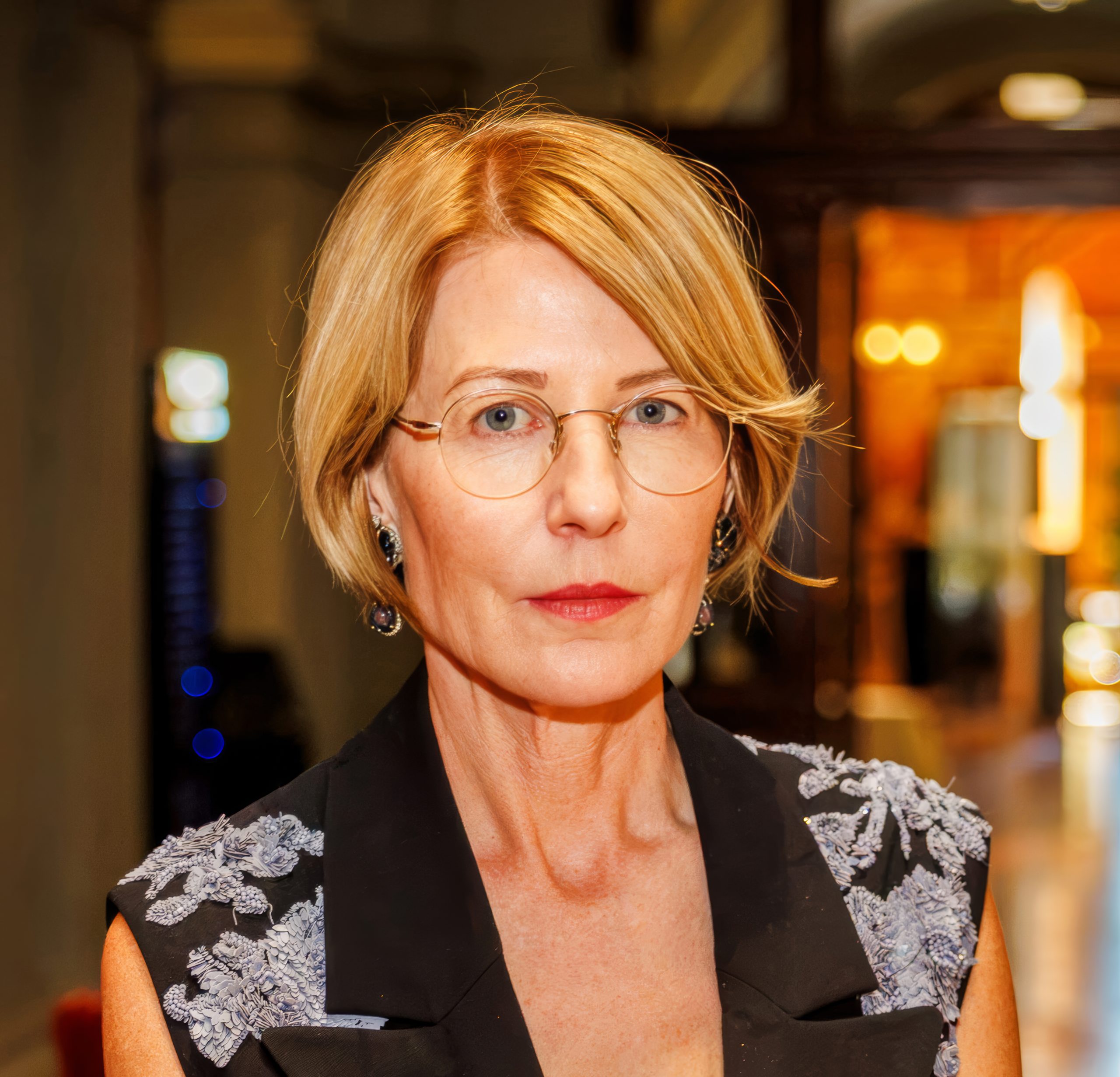
Professor Sarah Kenderdine
University of New South Wales
Thursday 12 November, 4:00 pm AEDT
Computational Museology: Between Machine Intelligence, Synthetic Objects, and Embodied Aesthetics
This lecture presents computational museology as a framework that repositions the museum as an anticipatory system linking cultural heritage, emerging technologies, and diverse publics. By integrating machine intelligence with data curation, ontology with visualization, and embodied interaction with immersive interfaces, museums can form new connections between objects, knowledge systems, and participatory practices. Discriminative AI reveals hidden relations within cultural big data—such as Narratives from the Long Tail, which generates narrative coherence across 200,000 hours of archival video—while generative AI produces new cultural forms for public co-creation, as seen in the Public Portal to Anticipation. Through examples of replicas, digital surrogates, and “cultural deep fakes,” the lecture explores how computational techniques reveal unseen patterns in cultural artefacts and challenge ideas of authenticity, authority, and the future of heritage.
Professor Sarah Kenderdine is a leader in interactive and immersive experiences for museums and cultural heritage. She is Professor at EPFL, Switzerland, where she leads the Laboratory for Experimental Museology (eM+), and Curator-at-Large of EPFL Pavilions. She pioneered computational museology, integrating AI, data curation, and immersive interfaces for cultural knowledge. She has created over 180 exhibitions and installations worldwide and co-authored Deep Fakes: A Critical Lexicon of Digital Museology (Routledge, 2025). She is a Corresponding Fellow of the British Academy.
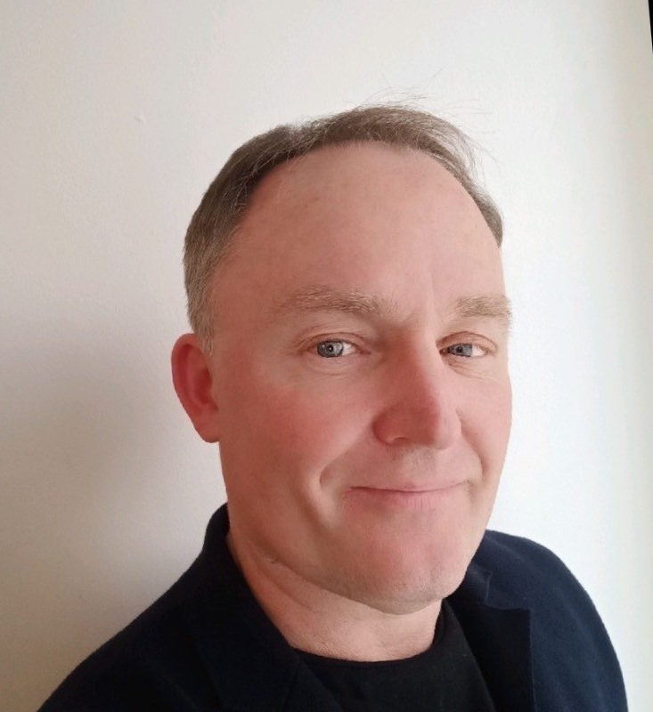
Professor Erik Champion
Adelaide University
Thursday 12 November, 5:10 pm AEDT
Digital Heritage: The Living and the Dead
This talk will focus on the issue of increasing the usefulness and impact of digital heritage simulations and immersive visualisations. How can aspects of gamification, low-cost technologies of capture and visualisation, plus methods drawn from citizen-science, help increase visitation and understanding in this nascent era of hallucinating AI and corporate-driven Digital Multiverses?
Erik Champion is Professor of Virtual Heritage and Interactive History at Adelaide University and directs the Playful Cultures Lab, part of the Australian Research Centre for Interactive and Virtual Environments (IVE). He is Emeritus Professor at Curtin University, and Honorary Professor of Games, Immersive Media & Extended Reality, at the University of Salford, UK. He has written and edited books on the intersection between serious games and digital heritage, and teaches 3D digital media, architectural history, and game design.
See the schedule for keynote times in other time zones.
Papers and Lightning Talks
From coordinates to the map: map-based geometry capture and spatial data quality in Arches-based heritage documentation
Salahaddin Ebrahimipour, University of Oxford, United Kingdom
Spatial location is the foundation of every record in a heritage inventory: condition assessment, threat monitoring and protection decisions all depend on knowing where a heritage place is and what it covers. Arches, the open-source heritage data management platform developed by the Getty and WMF, now underpins national and regional heritage inventories widely, including the Endangered Archaeology in the Middle East and North Africa (EAMENA) database, which documents more than 338,000 records of threatened heritage. Yet the step at which a place first acquires its geometry has received little attention. In the conventional Arches workflow, sites are located in external software such as Google Earth, their coordinates converted to GeoJSON with further tools, and only then entered into the record: a form-first process that is slow, depends on user extra labour, and introduces avoidable errors such as transposed coordinates and invalid geometries. This paper presents EAMENA Quick Pin, an Arches plugin that reverses this order through location-first recording: the user finds the site on the base map of the plugin within Arches, places a point or draws a polygon, saves it as a new Heritage Place, and then adds its attributes. We argue that data-entry design is a data-quality intervention, not a technical convenience, and evaluate the tool against the existing workflow for efficiency, spatial accuracy and usability. The approach is transferable to other Arches implementations, particularly national heritage databases in conflict-affected and climate-threatened regions, where records are often created by heritage professionals and staff members with limited training.
Paper (15 minutes)
An Automated Archaeology: Conceptualising the role of AI and Robotics for the future of Australian Archaeology
Calum Farrar, Independent researcher, Australia
This paper considers trajectories for automation within Australian Archaeology and their implications for pedagogy, practice and preserving the role of the human archaeologist in knowledge construction.
Just prior to the Large Language Model boom of late 2022, digital archaeologist Jeremy Hugget (2021) published an article identifying how archaeologists were increasingly handing over their agency in the knowledge creation process to their digital tools. Specifically, he identified a hypothetical role reversal point between human and technological agency, where humans react more to technological stimuli, than technology to human stimuli. Machine learning and AI are shown to sit firmly on the high technological agency end of this spectrum. While most archaeologists have not yet replaced the majority of archaeological processes with low human agency automation, the opportunity to do so through combinations of computer vision, artificial intelligence and robotics makes doing so an increasingly realistic prospect. More so, archaeologists may find that the choice to retain agency over knowledge production is not theirs to make.
Three trajectories are considered, peripheral, mixed and full integration. Each draws upon existing, but isolated examples of high technological agency to visualise the futures they represent. Each also brings with it its own consequences within and outside the discipline, however it is essential that we conceptualise these futures before the means to shape them to our values and aspirations are taken from us.
Paper (15 minutes)
Experiencing the Inaccessible: Investigating AR-Driven Heritage Connectedness using the Christ Church Cathedral Case Study
Ziyang (Johnny) Huang, Human Interface Technology Laboratory New Zealand, New Zealand
Inaccessible heritage is gainning global attention as sites have been increasingly volunerable under changing global conditions, such as natural disasters and geopolical conflicts. My Human-Computer Interaction (HCI) research investigates how Augmented Reality (AR) can helps individuals with little or no prior connection to initially form early-stage connections to physically inaccessible heritage. Using the Christ Church Cathedral (CCC) in Christchurch as a case study, this research examines how people perceive heritage connectedness and discusses what effective, human-centred experiences in HCI should look like.
Lightning talk (5 minutes)
Ready, Set, Record! Recording Rock Art on Hard Mode
Andrea Jalandoni, Griffith University and Aja Reyes, Guam and Australia
Mahlac Cave, Guam contains one of the Mariana Islands’ most significant rock art assemblages, but recording the site presented an extraordinary set of challenges. Located on US military land, access was extremely restricted and further exacerbated by conservation requirements designed to protect endangered Mariana swiftlet (yåyaguak, Aerodramus bartschi), which limited team size, noise levels, lighting, and time on site. The cave’s tropical environment, steep guano-covered ledges, and difficult access further complicated documentation. This lightning talk presents the strategies used to overcome these constraints through a combination of terrestrial laser scanning and close-range photogrammetry. Working within tightly controlled field conditions, the project generated a comprehensive 3D record of the cave and its rock art while minimising impacts on the surrounding ecosystem. Framed as a video game, the presentation highlights how creative adaptation, careful planning, and digital recording technologies enabled successful documentation of a site where archaeological fieldwork often felt less like research and more like playing on nightmare mode
Lightning talk (5 minutes)
The A-SHAPE Scanner: A Simple, Scalable, Open-Source Photogrammetry Scanner for Digitizing Cultural Collections
James Keal, Flinders University, with James Hewitt and Jarrad Kowlessar, Australia
Creating 3D models of cultural artefacts makes connection to those artefacts possible for Traditional Owners, researchers, and the general public, and enables quantitative analyses of their three-dimensional geometry. Photogrammetry is appealing for this purpose, accurately capturing shape and surface colour using comparatively inexpensive hardware. However, manually photographing the hundreds or thousands of specimens held by many cultural collections is prohibitively time consuming, motivating the development of automated, high-throughput imaging systems.
We introduce the A-SHAPE scanner, an open-source, largely 3D-printable image acquisition device suitable for fully-automated 3D photogrammetry while remaining simple and approachable in design. The device’s size is parametric, allowing any facility to easily tailor it to scan artefacts at a specific scale, across a wide range of scales. The accompanying control software allows image acquisition sequences to be customized for a given object geometry or analytical outcome. We demonstrate the value of this device through the successful scanning of ceramic artefacts with a wide variety of sizes, typologies, and geometric complexity. The method proved robust and capable of digitizing hundreds of artefacts sequentially, taking 200 photographs per artefact in less than 5 minutes, without human intervention. Reproducible acquisition sequences also unlock forms of machine learning analysis that demand consistent training data.
It is our hope that the open-source, approachable design of the A-SHAPE scanner will lower the barrier-to-entry for automated photogrammetry and foster an interdisciplinary community around digital heritage.
Paper (15 minutes)
Simulating the Virtual Songlines: Computational Archaeology, Real-Time Digital Twins, and Indigenous Data Sovereignty Across Brisbane, Sydney, Melbourne, and Perth
Brett Leavy, Bilbie XR Labs, Australia
Modern Australasian cities conceal rich, multi-millennial First Nations landscapes beneath concrete infrastructure. Synthesising Brett Leavy’s doctoral research with Bilbie XR Labs’ Virtual Songlines framework, this work reconstructs deep-time heritage across four major urban basins: Brisbane (Maiwar), Sydney (Warrane), Melbourne (Birrarung), and Perth (Derbarl Yerrigan).
By coupling museum, historical discourse, cultural heritage mapping, satellitte mapping, with real-time UE5 game engines and procedural eco-botanical simulation, the pipeline moves beyond static GIS layers to model dynamic, immersive and interactive pre-contact socio-ecological systems from fragmented archaeological records, including shell middens, lithic scatters, historical accounts, old paintings, and buried hydrology.
Crucially, the methodology embeds Indigenous Data Sovereignty directly into spatial architecture using role-based access, fine-grained spatial redaction, and community-guided protocols to safeguard sacred sites. Applicable to complex international urban-overlay contexts, this approach provides a scalable, community-first paradigm balancing cutting-edge spatial computing with deep-time cultural stewardship and local autonomy and integrity.
Paper (15 minutes)
Reconstructing Late Jōmon Foraging Patterns Through Sclerochronology and GIS
Jen Mahendaran, La Trobe University, Australia
Nerita albicilla shells from the Late Jōmon site of Shimotakabora, Izu Ōshima, offer an opportunity to investigate prehistoric coastal foraging and environmental change. Combining sclerochronology with Geographic Information Systems (GIS), this study examines shell growth and isotopic records alongside spatial and environmental data to explore the seasonality and location of shellfish collection. These findings can provide insights into coastal resource use and how Jōmon communities responded to environmental variability. This approach demonstrates the potential of combining shell-based environmental reconstructions with spatial analysis to investigate prehistoric subsistence strategies, seasonal resource use, and human–environment relationships.
Lightning talk (5 minutes)
Correlation Between “Weapons” and Wounds at the Kamikuroiwa Site in the Jomon Period
Tomomi Nakagawa, Nagoya University, Japan
This presentation details the results of a comparison between the shapes of two holes on a pelvis and bone tool excavated with the pelvis from the Kamikuroiwa Rock-shelter Site in Ehime Prefecture. The human skeletal remain (No. 6902) was excavated with a bone tool embedded in the pelvis. However, later research suggested that a nearby hole has a similar shape and was caused by a bone tool. Consequently, Nakagawa (2022) created 3D models of the holes and the bone tool, comparing the shapes of each hole to the cross-section of the bone tool. The analysis revealed no differences in shape between the two holes and the bone tool. However, this analysis did not account for the cross-sectional shape of the bone tool when embedded at an angle. This presentation reports the results of an analysis that includes additional oblique-angled cross-sectional data on the bone tool.
Lightning talk (5 minutes)
New Routes for Accessibility in Digital Archaeology
Corey Noxon, Ritsumeikan University, Japan
Efforts to improve accessibility in digital archaeology have increasingly emphasized open data, reproducible code, interoperability, and responsible data stewardship, often guided by FAIR and CARE principles. These practices have significantly improved the transparency and reusability of archaeological research. However, making data and code available does not necessarily make analytical methods approachable to researchers, especially those without extensive programming experience.
Recent advances in large language models (LLMs) offer new opportunities to address this gap. By assisting with software development, LLMs can help researchers create graphical user interfaces (GUIs) that make complex analytical workflows easier to understand, reproduce, and adapt. Such interfaces can allow users to explore datasets, modify analytical parameters, and apply established methodologies to new research questions without directly modifying the underlying code.
This presentation explores these possibilities through two ongoing projects: a photogrammetry toolkit designed to simplify and document archaeological 3D recording workflows, and a toolkit for Locally Adaptive Modeling of Archaeological Potential (LAMAP), which supports the exploration and adaptation of landscape-based archaeological analyses. Drawing on practical development experiences, the presentation considers both the opportunities and challenges of LLM-assisted tool creation, including validation, transparency, and long-term sustainability.
Building upon established principles of open and responsible research, accessible interfaces offer an additional pathway toward making digital archaeological methods more approachable, adaptable, and usable by a broader range of researchers than code and data alone.
Paper (15 minutes)
Reconstructing Jomon Mortuary Practices through Bone Histology
Dan Osaka, University of Tokyo, Japan
Human remains recovered from archaeological sites provide evidence of past mortuary practices, but their condition at excavation reflects the cumulative effects of postmortem processes. Reconstructing events such as decomposition, exposure, cremation, and secondary burial therefore requires more than macroscopic observation.
This study uses histotaphonomy, the application of bone histology to taphonomic research, to investigate mortuary practices among Jomon hunter-gatherers in prehistoric Japan. Particular attention is given to bioerosion, a form of microscopic bone alteration associated with microbial activity during decomposition. Light microscopy, scanning electron microscopy (SEM), and digital image analysis are combined to identify, visualize, and quantify changes in bone microstructure.
This approach is applied to calcined human remains from two Late Jomon sites in north-central Japan. Histological observations are combined with macroscopic evidence, including curved transverse fractures, to assess whether cremation occurred while soft tissues were present or after decomposition. Differences in microscopic preservation suggest that bones within the same assemblage may have experienced different pre-cremation histories.
A digital image analysis workflow was developed to delineate bioerosion-like features in SEM images and quantify the proportion of bone area affected. Preliminary analyses of unburnt human and animal remains from Jomon contexts also show variation in microscopic alteration, providing a basis for comparing postmortem histories and depositional conditions.
Although further validation is needed to distinguish microbial bioerosion from other microscopic alterations, integrating histological and quantitative evidence with archaeological context may improve reconstructions of mortuary practices and the processes shaping archaeological skeletal assemblages.
Paper (15 minutes)
From Pattern Detection to Deep Listening: Relational AI, Dadirri, and Ethical Interpretation in Digital Archaeology
Sylvianne Quin-Wright, Independent researcher, Australia
AI has rapidly expanded archaeology’s capacity for pattern detection—classifying artefacts, mapping landscapes, aligning multimodal datasets, and scaling analyses—yet interpretation remains relational, situated, and ethically accountable to communities and Country. Drawing on Dadirri as an Indigenous place-based methodology of deep listening and on object biography and decolonial literatures, this paper proposes a relational AI model: an AI-assisted interpretive workflow governed by custodial authority, deep-listening protocols, and human-in-the-loop validation (Ungunmerr-Baumann et al. 2022; Gosden & Marshall 1999).
The model reframes computational outputs as provisional relational hypotheses rather than definitive claims, requiring iterative custodial review, provenance tracking, refusal rights, and culturally sensitive access controls before public dissemination. It outlines practical mechanisms for Dadirri-informed governance across the research lifecycle: co-design and negotiated consent; multimodal data capture that foregrounds oral histories and custodial annotations; ethical pipeline layers that support redaction, access control, and contextual explainability; and evaluation metrics that privilege cultural fidelity and custodial satisfaction over narrow accuracy metrics (Kukutai & Taylor 2016; Kansa & Kansa 2013).
The paper also advocates cross-platform triangulation, treating outputs from diverse AI systems as complementary perspectives within a custodially governed interpretive ensemble, reducing single-model overconfidence while preserving methodological transparency. By centring Indigenous Data Sovereignty and decolonial AI principles, relational AI seeks to prevent computational flattening and epistemic extraction while amplifying custodial epistemic authority (Mohamed et al 2020; Bird 2020). The central claim is concise: some archaeological knowledge cannot ethically be inferred at machine tempo; AI should help archaeology listen better, not merely see faster.
Paper (15 minutes)
Presenting Country: mesh-and-splat digitisation with First Nations cultural centres in NSW
Michael Rampe, CAA-A committee member, with Steve Miller, Australia
Rampe Realistic Imaging (RRI) has partnered with the Aboriginal Culture, Heritage & Arts Association (ACHAA) and four NSW Aboriginal Cultural Centres — ACCKP (Armidale), Wungunja (Trangie), Yarkuwa (Deniliquin) and Yarrawarra (Corindi Beach) — to prototype a virtual NSW Aboriginal Cultural Centre. Working with each local community as data custodians and with ACHAA coordinating across centres, we have redefined how archaeologically significant and living-culture artefacts can be digitised and presented respectfully on Country, rather than abstracted onto a neutral background.
Objects are captured with either full-material 3D scans (PBR meshes) or 3D photo captures (Gaussian splats), whichever best suits the piece. They are presented inside a virtual cultural centre — a pseudo-museum context carefully integrated into the surrounding landscape, so a viewer can also step outside and discover the same items in the context of place. Both the centre and the landscape combine mesh in the foreground with splat behind. Running in a browser on any device, from a phone to a VR headset, a Wamba Wamba stone tool at Yarkuwa can be examined inside the virtual centre or found along the river where it may have been traditionally used.
We argue this combination — mesh in the foreground for detail you can touch, splat in the background for the space you’re standing in — is broadly applicable to any archaeological context where both material and setting carry meaning. Equally important is the governance layer that lets each centre decide what is digitised, what is shown, and to whom — a community-led workflow that scales well beyond our four partners.
Paper (15 minutes)
3D Modelled Artefacts in Australian Universities: A Nation-Wide Survey of Australian Archaeology Departments, History Departments, and Museums.
Thomas Romanis, Monash University, Australia
With decreasing access to artefacts and a decline in university archaeological collections in recent decades, some Australian universities are exploring the use of 3D modelled artefacts in their classes. Historically, these have predominately been web-based models of scanned artefacts that students engage with online via a computer and personal devices. In recent years, there have been increasing capabilities and decreasing costs to a variety of other 3D technologies, such as Augmented Reality, Virtual Reality, and 3D printing. However, it is unclear to what extent these technologies are being utilised within archaeological education and what current industry views on these technologies are.
This presentation will discuss a recent survey conducted as part of a PhD exploring the use of 3D modelled artefacts in AR, VR, and 3D printed modalities within Australian archaeological classes. 42 archaeological lecturers, tutors, and museum workers from 21 Australian universities were interviewed about their experiences using these technologies and on what they view the benefits and limitations are for using them to teach archaeological students. The results provide a detailed portrayal of the current use and perceptions of 3D modelled artefacts in Australia and an indication of future applications in the sector.
Paper (15 minutes)
Practical Uses of Photogrammetry and Geometric Morphometrics in the Identification of Species from Fragmented Remains
Isobel Simpson, University of New England, Australia
The identification of faunal species in zooarchaeological assemblages usually involves experienced personnel analysing the remains against an established reference collection, either physical or digital. Three-dimensional models of skeletal elements are increasingly more useful in these situations, particularly as photogrammetry evolves and becomes more accurate and efficient. This process becomes more complicated, however, when rare or extinct species are under analysis, and even more so when these remains are in a fragmented condition. Positive identification of these specimens then relies entirely on the experience of the analyser or zooarchaeologist.
This study examines the utility of photogrammetry (PHG) and geometric morphometrics (GMM) in the identification of fragmented archaeological and palaeontological faunal remains. It aims to determine the applicability and accuracy of using these digital methods to distinguish between species and identify highly fragmented remains more broadly. To address this, three-dimensional (3D) models of tibias from three species have been compared; modern and Pleistocene-aged Macropus giganteus (the Eastern Grey Kangaroo), Pleistocene Protemnodon anak (an extinct macropod species), and modern Homo sapiens, as well as a tibial fragment from an unidentified macropod species. A closed curve semilandmark approach was utilised on four tibial sections: the proximal epiphysis, proximal epiphyseal plate, distal epiphyseal plate, and distal epiphysis. This presentation will analyse the methodology used for this technique and the results of the research, as well as the limitations of using the method for accurate species identification. Lastly, applications for future research and where this method might be most useful will be discussed.
Paper (15 minutes)
Visual Analysis of Large-Scale Tangible Cultural Heritage Using High-Visibility See-Through Visualization
Satoshi Tanaka, Ritsumeikan University, Japan
Three-dimensional (3D) scanning is widely used to digitally preserve cultural heritage as large-scale point clouds. These datasets contain detailed information about the shape and structure of heritage objects and buildings. However, when complex structures are visualized transparently, overlapping points can make both external and internal features difficult to understand. This presentation introduces a high-visibility see-through visualization method for exploring such large-scale 3D scanned data. The method adaptively controls the opacity of different regions by changing the lighting direction, allowing selected structures to be highlighted without modifying the original point cloud data. Interactive changes in lighting also enable users to explore different parts of complex structures dynamically. The method is demonstrated using 3D scanned cultural heritage data, including UNESCO World Heritage sites. The results show that architectural details and internal structures that are difficult to recognize using conventional visualization can be made more clearly visible. The approach provides a practical means of visually exploring large-scale digital heritage data and may support the analysis and interpretation of complex tangible cultural heritage.
Paper (15 minutes)
Mapping a possible monumental Mughal garden in Afghanistan
David Thomas, Independent researcher, with Greg Hil, Australia
A Google Earth survey of the Darya-e Ghazni valley in southern Afghanistan in 2010 identified a large, previously undocumented, walled enclosure. We suspected the site, which is 50 km south of Ghazni, was an monumental funerary garden, based on its size (approximately 375 m by 325 m), layout and what appeared to be an isolated mound (a domed mausoleum?) on its south-eastern side. Little else could be said, due to the low resolution of the satellite imagery which was freely available at that time, and the volatile security situation which precluded the prospect of a site visit.
Higher resolution satellite imagery, however, has since become available which has prompted a more detailed investigation of the site. Using a combination of archival declassified spy satellite imagery, Google Earth, ArcGIS Earth and ASTER imagery, integrated with available historical and documentary evidence, we have mapped the site in more detail and started to consider it in its historical landscape setting.
Seasonal river channels are eroding parts of the site, so it was particularly important to understand the local fluvial geomorphology. A brief site visit has recently been undertaken by our colleagues in Afghanistan, who have now added the site to the country’s archaeological gazetteer. The investigation highlights the value of integrating remote sensing with historical, documentary, and field-based evidence to investgiate archaeological landscapes, particularly in remote, difficult to access areas. Our presentation will conclude by outlining possible future avenues for research, both using remote geo-spatial data and fieldwork.
Paper (15 minutes)
Other People’s Data: Working with data you didn’t collect
Karen Thompson, University of Melbourne, Australia
Archaeological datasets have histories. This talk considers what happens when we work with data we did not collect, using a case study of khipu characterisation data assembled over more than 60 years from objects in varying states of preservation. The dataset represents the work of more than twenty data collectors, each making their own judgements about what was useful to record. Their differing priorities produced different data models, which were subsequently entered into a single database through multiple stages of transcription, including by uncredited students.
Working with this dataset requires more than assessing data provenance or quality. It requires reconstructing its history: who recorded what, why, how those observations were transformed, and what was lost or introduced along the way. Through examples from the dataset, I explore the interpretive judgements required to make these data comparable, and their implications for formulating, conducting, and interpreting data-driven analyses.
[This work is a continued development of work presented at Digital Humanities Australasia in December 2025, and in a talk to Harvard Andean Working Group in March 2026.]
Lightning talk (5 minutes)
Simulating the Agricultural Transition in Japan: A Yayoi Period Application of an Open-Source Agent-Based Simulation GIS
Stephen West, Tokyo National Museum, with Hayato Kasuga, Japan
Demography is an important lens through which we can understand past societies, and the Yayoi period witnessed one of the most significant demographic transitions in Japan, as indigenous people mixed with migrants from continental Asia to create a sedentary agrarian culture. However, the population dynamics of this period remain poorly understood due to a lack of quantitative methods for testing demographic hypotheses. In this study, we simulate the Yayoi period using Pax Sapientica, an open-source GIS that supports agent-based simulations. We integrated data from archaeology, ethnography, physical anthropology, and ancient DNA to set parameters for a base model and tested alternative models by adjusting experimental variables. These experimental models were used to evaluate hypotheses regarding the number of migrants from continental Asia, the marriage rules of agents, the distance and frequency of migration, and the transmission of agricultural subsistence. Finally, we assessed the validity of each model by comparing the simulated results with expected values for total population, the percentage of agents with continental Asian genetic heritage, and the distribution of intensive agricultural subsistence. The results suggest that a consistent flow of migrants from continental Asia is necessary to explain the development of Yayoi culture, and that intensive agriculture spread through a combination of migration and admixture with Jomon hunter-gatherers. While agent-based modeling in archaeology is often abstract, this study demonstrates the utility of realistic, spatially defined simulations that integrate GIS and interdisciplinary data.
Paper (15 minutes)
Sandstone Scanning
Susan Whitby, Aboriginal Heritage Office, with Kyle Nettleton and Phil Hunt, Australia
The Aboriginal Heritage Office (AHO) is a unique collaboration funded by five Local Government Councils across the northern part of Sydney, Ku-ring-gai, Lane Cove, North Sydney, Northen Beaches and Willoughby. The primary focus of the AHO is monitoring and conservation of Aboriginal sites within the partner LGAs and public education through school and community programs. The AHO is always looking for up-to-date conservation and education tools. With this focus in mind, the AHO has continued its exploration into digital archaeology technology options that would be cost effective and simple to include in our current education and conservation methods.
In 2025, the AHO began a new 3D scanning project of the key registered Aboriginal sites located within the partner Council areas. This ongoing project is exciting, and we wanted to share with you all some of the results of the work so far and celebrate the amazing Aboriginal cultural heritage surviving in these much-impacted landscapes. The 3D scans are visually engaging and the AHO intends to use the images to captivate and inspire younger audiences in school groups and within the broader community.
Lightning talk (5 minutes)
Beyond the Splat: Multi-Fidelity Spatial Experiences for Archaeological Evidence
Daniel Woo, UXED P/L, Australia
Emerging 3D reconstruction technologies offer new opportunities for archaeological documentation, but no single representation adequately serves every purpose. High-resolution photography preserves visual detail, point clouds provide measured geometry, and Gaussian splatting enables navigable spatial experiences, albeit with reconstruction artefacts and reduced photographic fidelity.
This presentation explores a multi-fidelity approach to spatial documentation, examining how complementary capture technologies and representations can support both immersive exploration and access to original evidence.
Experiments using existing high-resolution nodal panoramic photography of historical scientific facilities at ANSTO demonstrate the feasibility of reconstructing navigable environments from sparse photographic viewpoints. Comparisons between two-node corridor and four-node open-area reconstructions reveal differences in geometric coherence and suggest opportunities to reconsider photographic capture topology.
Complementary experiments demonstrate an independent workflow converting Insta360 video into Gaussian splat reconstructions, with WebXR providing desktop navigation and stereoscopic immersive viewing. Further investigations consider hybrid capture strategies combining nodal photography, handheld imaging, stereo camera arrangements and measured camera positioning.
Drawing on human-computer interaction and spatial computing, the work considers how users might move between representations according to their needs: navigating reconstructed environments, examining high-resolution photographic observations, and comparing geometric information from historical point clouds or CAD models.
Rather than treating reconstruction as a replacement for original documentation, the proposed approach positions spatial environments as interfaces to evidence, preserving the distinction between observation and computational interpretation.
The presentation invites discussion on capture methodology, representation fidelity, immersive interaction and the evolving role of spatial computing in archaeological research and heritage documentation.
Paper (15 minutes)